Luckily the sky was almost perfectly clear today. An incredibly beautiful composition of widely ramified fjords, dark green pristine forest, and snowcapped mountain
tops, some of them volcanoes, became visible. No, this was not Norway. The aircraft was moving straight towards the South along the Chilean coastline. The view gave me a first taste of what would
await me during the next three weeks.
Aysen – Chile’s most sparsely populated region
The scenery became more and more dramatic, and finally we arrived at Balmaceda airport. This is a rather isolated place situated at the border to Argentina, where the temperate rainforests already have given way to the arid pampa. These sharp contrasts are located very close together here. Few tens of kilometers further and an entirely different ecosystem can be discovered.
After a total of 26 hours on the road, or rather mainly in the air, I arrived in Coyhaique, the capital of Aysen. With its 0.9 inhabitants per km², this is the most sparsely populated region in entire Chile, although its area is larger than those of for instance Hungary or Portugal! Coyhaique itself turned out to be a lively little city with good restaurants and decent infrastructure, which makes it a meeting point for young travelers, especially those moving with their bikes along the Carretera Austral.
I used the first day to arrange ethyl alcohol for my cooking system, which proved to be more difficult than I hoped for. Finally, the local “ferreteria”, which is kind of a hardware store, could help out. And, of course, I stocked up my energy reserves in the local restaurants, before I would head towards the Reserva Nacional Cerro Castillo very early the next morning.
Cerro Castillo – Patagonia’s “most beautiful scree”
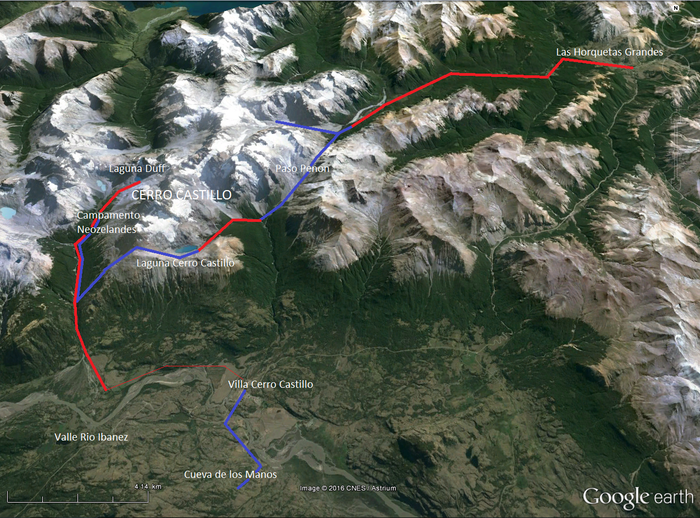
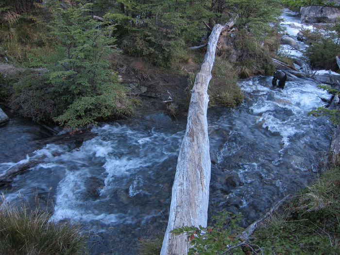
Right in the middle of nowhere, a place called Las Horquetas Grandes, I left the bus after an one and a half hours’ drive. But I wasn’t the only one. Also Roberto, a young Italian, wanted to do the same trek. Right at the beginning, a little stream had to be crossed. I let Roberto go first, since I was going to have a second breakfast before the start. “I think you might need to take off your shoes”, I said, when he looked a little uncertain. “Fuck, this is freezing cold!”, he screamed while wading through the water. I went a little closer, looked to the left, and could hardly believe what I saw there. Maybe 20 meters away, there was a bridge connecting comfortably to the other river bank…
However, crossing streams was necessary later, but never a problem during this tour. After an easy walk on a dirt track, for the first time the silhouette of the Cerro Castillo mountain range became visible from the distance. Looking like a fairy-tale castle (“castillo” actually means castle), it was simply stunning!
The trail went on through beautiful Lenga forests, and winded up towards Paso Penon. There I realized why the Cerro Castillo was also called the most beautiful scree of Patagonia. While the pass itself was still covered by old snow on its southern side, the steep descent (approximately 45° steep) on the loose stones was extremely slippery, even with trekking poles.
The national reserve was fascinating, and even much better than I had expected before. Unbelievable, how the low-quality pictures in the brochures could not reflect reality. The spectacular shapes of the mountains, together with the beauty of their powerful glaciers and the peace of the surrounding pristine forests are breathtaking.
The “Laguna’s” – From turquoise to deep blue
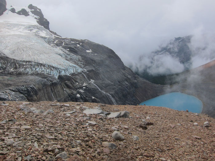
And, not to forget, the crystal-clear colors of the mountain lakes! I was lucky to find a small spot suitable for camping right next to the perfectly turquoise Laguna Cerro Castillo. Even swimming was possible that afternoon. Well, let’s rather call it taking a quick bath. Although warmer than expected, the water in the little lagoon directly fed by the glacier above felt like 12 degrees cold. During the evening and night, the ice was calving from the glacier and crashing down with tremendous noise on the rock face right on the other side of the little lake.
The next day, I met Alfredo and Javier, two ecotourism students from Santiago, on the way to Campamento Neozelandes. First we had to climb over the scree of Cerro Castillo again, up to a ridge far above the Laguna. It was good to meet other people here, also because orientation might have been more difficult otherwise. The very low clouds limited the sight and the upwinding trail was not always easy to spot on the boulder fields.
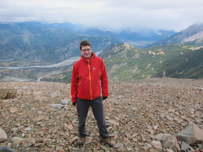
Eventually, we reached the top when the sky opened up. For the first time on this trek, there was even mobile coverage up here. About 1200 meters below, the Valle Rio Ibanez and, close to the horizon, even the Lago General Carrera became visible. Everything seemed so far below that it felt like being on a different planet up here. And it looked like a long way to go down.
And it was. Again, the loose boulders were a little tricky, but fortunately the rain from that morning had stopped for a while already. Otherwise, this descent wouldn’t have been a pleasure. This part of the route was more frequented by people, but the camping in the place called Neozelandes was nevertheless a great spot. From here, it is possible to climb the Cerro Castillo mountain ridge from its rear, provided that you are a professional climber obviously. Instead, I headed up to the Laguna Duff, another gorgeous mountain lake, this time in a darker blue color. For the first time I could feel the extremely squally Patagonian wind up here and gave up on the idea of taking another bath in that place.
Cueva de los Manos in Villa Cerro Castillo – Positives and negatives
I was lucky to get a ride on the last, not the most spectacular part of the trek which was leading on a dirt track to Villa Cerro Castillo. This is a little village at the Carretera Austral, the road connecting Northern and Central Patagonia on the Chilean side, with lots of cheap accommodations, but not much more infrastructure. I ended up in one of those cheap hostels, but unfortunately it turned out to be a very noisy one which was mostly used by Israelis looking for party rather than relaxing from a strenuous trekking tour… At least I managed to find an open restaurant which had exactly one dish to offer: Beef with mashed potatoes. Accompanied by a “salad” consisting of tomato slices solely. The Patagonian cuisine is definitely not for vegetarians…
The next morning, I decided to complete my stay in this region with a visit of the local Cueva de los Manos. There cave paintings have been found, mostly of people’s hands. Both positives (direct impression of the hand on the wall) and negatives (outline of the hand) were visible. Although interesting, this site is probably not comparable to the more famous Cueva de los Manos in Argentina. Luckily another visitor carried me back to the village in his jeep, saving me the not very pleasant four kilometer walk back to Villa Cerro Castillo. Overall, this first trek during my visit to the Region of Aysen was fantastic, but there were more adventures to come.










Alfredo Rivera (Wednesday, 03 August 2016 22:58)
Hello Martin! Nice reading the story! it brought me back nice memories, what a good trek is that!. And nice writing and very good photographs!, interesting and fun, I imagined it perfectly.
I´ve been starting to write about my travels too, check out the Blog section of my webpage, www.alfredoriverafotografia.com (spanish and english), maybe I will write about this trek someday, hopefully soon. You can also see a video that Javier did, ( https://vimeo.com/128752119 ), hope it will bring you nice memories too. I almost fell on that chilean way bridge! hahaha.
Have a good time and keep on with the writting.
Greetings from Chile.
mariko (Monday, 29 August 2016 10:15)
Wow, brave of you to trek alone! I've always been drawn to Patagonia for the feeling in the landscapes... loved your pics :-)